

You can find on this page the Cyprus satellite map to print and to download in PDF. The Cyprus map from satellite presents new pictures of Cyprus as seen from the sky in Southern Europe.

The Cyprus satellite map shows new pictures of Cyprus as seen from the sky. This satellite map of Cyprus will allow you to visit the country Cyprus in Southern Europe as seen from the sky. The Cyprus satellite map is downloadable in PDF, printable and free.
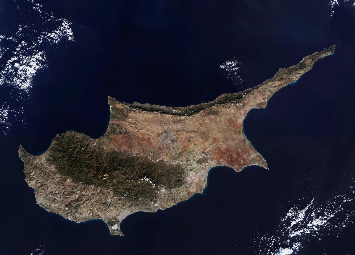
The satellite view and the map show the island of Cyprus, the third largest island in the Mediterranean Sea. The island is geographically already part of Asia (Middle East), located about 80 km (50 mi) south of the Turkish coast and about 120 km (75 mi) west of the coast of Syria. Cyprus shares maritime borders with Egypt, Greece, Israel, Lebanon, Syria, and Turkey. Cyprus covers an area of 9,251 km² in the Mediterranean Sea as you can see in Cyprus satellite map. About two-thirds of the area belongs to the Republic of Cyprus, and one-third is de facto under the control of the self-declared Turkish Republic of Northern Cyprus. The British Base Areas occupy 254 km².
Cyprus Locations as its shown in Cyprus satellite map: Akrotiri Bay, Cape Apostolos Andreas, Cape Arnauti, Cape Gata, Cape Greco, Cape Kormakiti, Famagusta Bay, Mediterranean Sea and Morphou Bay as its shown in Cyprus satellite map. The country is recognized for its quaint villages, coastal beaches, and historical sites. It is also the birthplace of Aphrodite, the Goddess of Love, who emerged from its waters. The Karpas Peninsula stretches out to the northeast of the country. Its finger-like shape is one of the most prominent geographical features of the island of Cyprus.
The Troodos mountain range dominates the center of Cyprus landscape. Along the northern shore of the island are the Kyrenia Mountains. To the south of the Kyrenia range lies the Mesaoria, a broad plain that extends from the Morphou Bay in the northwest to the Bay of Famagusta in the east as its mentioned in Cyprus satellite map. There are some smaller plains on the coast in the south, where the Paphos International Airport and the cities of Larnaca and Limassol are located.